There are many great reasons to take a vacation to the area of Cherokee. One, of course, is probably because you enjoy the outdoors. The other side of the National Park gets flooded with tourists. Therefore, you’ll wonder why many of them don’t come here to the North Carolina side. This is where they could be getting a much more enriched vacation. You may wonder this, but you’ll be happy that many of them stay over there. This is because the whole purpose for staying on this end of the Smoky Mountains is probably due in large part to how quiet it is here.
And this is where you can do the best hiking in the Smoky Mountains. You can do it without hassle of dealing with throngs of tourists. It’s so wonderful not worrying about getting to a trail early in morning just to get a good parking spot. You can get the chance to see a beautiful waterfall without taking turns. However, the morning is still the best time. This is especially true in the summer. You'll want to get a nice cool walk in before the heat of the day sets in.
30 Minutes Away
When you want to go hiking in the Smoky Mountains, and you’re staying near Cherokee, you’ll be approximately no later than 30 minutes away from some spectacular water displays along some trails that are easy to moderately difficult to hike. You’ll be dazzled by the wonderful displays of plant life and pieces of history along many of these trails. And you will also have plenty of time to gawk at these flourishes of nature with so few people around. You’re probably ready to hear about the following 6 trails! They have plenty of sights and sounds that’ll keep your mind at ease. This is while you let your feet do all the walking in the Smoky Mountains near Cherokee NC.
1. Smokemont Loop Trail
Don’t let the fact that this is a moderately difficult trail deter you from making this a priority when you go hiking in the Smoky Mountains. This trail is just a 15 minute drive from Cherokee. It can found by traveling into the National Park and locating the signs for the Smokemont Campground. The parking area will be across the bridge, and the trailhead can be picked up from this area. The entire Smokemont Loop includes another trail that’ll be discussed in detail later.
Bradley Fork Trail
The Smokemont Loop really isn’t a loop unless you consider it part of the Bradley Fork Trail. The Smokemont portion of the trail before it gets to this point is little more than a warm-up walk. This is for if you’re not ready for anything strenuous today. It runs parallel to the Bradley Fork section of the Oconaluftee River and is actually pretty flat. The first intersection you’ll come to is the Chasteen Creek Trail. However, since we’re going to do that later you’ll want to stay left to continue on to the Smokemont Loop portion. This is where you’ll cross a one-handrail bridge across the river. Now you’ll be coming up on the most challenging aspect of this trail. For the next hour or so, be prepared for some rough and continuous uphill climbing.
It can be a bit of a rough go if you’re not used to doing a lot of hiking in the Smoky Mountains. However there’s plenty of beauty to see on this trail for times when you need to take a little breather. In the spring, you’ll see many violets and hepaticas along the trail. If you’re hiking in the fall, there will be many leaves scattered along the trail as well. Therefore, you might want to be careful with your footing here at this time of year.
Unmarked Trail Part
At the end of this trail, you’ll reach a point in a road that’s unmarked. Most people find it better to stick to the path near the river. This is instead of meandering through the campground to get back. You’re probably quite tired at this point. Therefore, there’s no need for you to make it any more difficult when all you want to do is get back to your car.
Two interesting and historic sites that shouldn’t be missed include the Smokemont Baptist Church and the Bradley Cemetery. The latter can be found at the end of the trail near the campground. Heading down a slope, you’ll come to this cemetery. It's named after the family that settled here in the early 19th century. Some of the graves are weathered, but they have the names of the Bradley, Wilson, and Reagan family names inscripted on them.
The Smokemont Baptist Church was once named the Lufty Church. Its beginnings trace back to 1829, but the church itself was erected in 1896. It can be found by looking across the road and up the hill in the parking area. The nice part is being able to walk inside and imagine being a part of the congregation over a century ago. Admire the architecture as you’re dreaming; the pulpit in the front is plain, without any decoration or cross. The final services were held here in 1935.
2. Chasteen Creek Trail
If your idea of hiking in the Smoky Mountains doesn’t include hiking the entire Smokemont Loop Trail near the campground, there’s another highly rewarding one-way trail that you can take for a much easier day hike. The Chasteen Creek Trail is a side trail reached after going about 1.2 miles on the Bradley Fork portion of the Smokemont Loop. Continue on the trail for a little over a half a mile before coming to a horse trail at an old horse rack. After another one-fifth of a mile you’ll reach the Chasteen Creek Cascades.
Backcountry Campsite #50
A few interesting aspects about this trail start near the beginning where you’ll run into Backcountry Campsite #50—one of the most accessible streamside campsites in the Smoky Mountains. It’s a great site for beginners with young children and influence their future desires to do more adventurous backpacking. It’s also a fantastic start to doing some backwoods camping that doesn’t feel like you’re too deep into the wilderness, making it more appealing to those just starting out.
While the Chasteen Creek Trail continues on, let’s just say you want to get to the cascades, but prior to that is the horse rack mentioned earlier. You may wonder what the deal is with this, but it’s actually somewhat of a horse trail for those doing some horseback riding here. Don’t be surprised if you encounter some on your hike and be wary of a muddy trail that might be as a result of some heavy horse traffic to go along with some rains.
Roaring Rush of Mountain Water
The cascades themselves can be described as a roaring rush of mountain water that’s highly common to find when hiking in the Smoky Mountains. Whitewater here is quite plentiful, and a trip along this route is not only fairly easy—less than 4 miles of only an increase in elevation of just over 300 feet—it’s also quite calming, as you’re never beyond the sounds of water from the river and the cascades that are nothing short of impressive.
An added feature of this trail is also commonplace when hiking in the Smoky Mountains. Since you’re not in a high elevation, this will give you ample opportunities to see the many trillium, foamflower, and violets scattered about the ground around this scenic little trail. Other common flowers sitting by the banks of the river include the lovely mountain laurel and rhododendrons.
Chasteen Creek Trail
For a more strenuous hike, you have the option of continuing on the Chasteen Creek Trail, but many just take this trail as a side trip from Smokemont Loop to catch a glimpse of some beautiful gushers that are recommended views when hiking in the Smoky Mountains. The Chasteen Creek Cascades is certainly no exception in this great little area near the Smokemont Campground.
3. Mingus Creek Trail
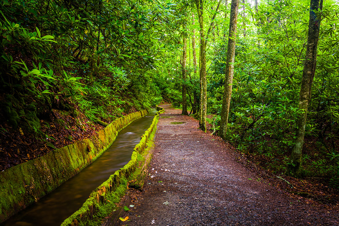
One of the closer and more popular trails of this sometimes overlooked area near Cherokee is the Mingus Creek Trail. This can be reached by driving past the Oconaluftee Visitors Center and turning into the Mingus Mill area—just a 10 minute drive from Cherokee NC. The trail—and the mill—is named after John Jacob Mingus, who arrived in the valley in the 1790’s and was the first European-American to settle within the confines of the national park.
The Mingus Mill should be the first thing you do before you even set foot on the trail. It was built in 1886 and still runs today, with demonstrations on the entire process, and cornmeal that can be purchased here that ground on-site. The site is closed in the winter months but this certainly is a must-visit.
Mingus Creek
After about 500 feet into the hike, the mill starts diverting water from Mingus Creek, and after about a half a mile, you’ll pass the park ranger shooting range. Another interesting aspect about this first mile—and just one of the many fascinating facts you’ll learn when hiking in the Smoky Mountain—is that it was an old road bed constructed by the Civilian Conservation Corps in the 1930’s. This was a public relief program made up of mostly unmarried, unemployed young men—part of President FDR’s New Deal that was especially important in Tennessee (the TVA, for one).
The first mile consists of some pretty easy terrain for walking, but it won’t stay like this the whole trail. Watch your step as it get rockier and much more narrow. Soon, you’ll pass over two little footbridges that cross over small streams, and then you’ll come to a fork in the trail. There’s a small family cemetery on the right for a quick view if you’d like, but to continue on, you’ll want to go left.
Deeplow Gap trail
At this point in the trail, you’ll really feel like you’re hiking in the Smoky Mountain, as you’ll start inclining sharply. Another challenge comes shortly after the fork, and it comes in the form of a decent creek crossing. Heavy rains could make this challenging, but there are rocks and a log to help you get past this obstacle.There will be other creek crossings that follow, but none will be as difficult as the first. When you reach the Deeplow Gap Trail, this is the point where you can turn back, and then when you return, you can say you conquered another trail for hiking in the Smoky Mountains.
4. Deep Creek Loop
The next trail that’s fantastic for hiking in the Smoky Mountains is located 10 miles south of Cherokee near the town of Bryson City. The Deep Creek area is another scenic place full of hiking trails and waterfalls that are good for novice and expert hikers. So much history and visual wonders are all over this idyllic little wonderland of nature. The Deep Creek Loop Trail is one such hike that is representative of everything that’s special about this area of the Smokies.
This trail is one of the few in the area that offers multiple falls on a single hike that won’t take you all day to traverse. Hiking in the Smoky Mountains offers plenty for the sightseers, but this particular one is worth more than just a look. Its moderate difficulty should mean it’s worth at least an attempt for the beginner.
Tom's Branch Falls
The trail begins with immediate rewards in the form of wildflowers, and the first waterfall on the hike—Tom’s Branch Falls. This is an impressive 80-foot-tall wonder that spills into the creek. You can tell how much the Park Service thinks of this natural creation. Installed benches were constructed so you can sit, watch, and listen to the sounds of water splashing down the ledge.
The wildflowers are another beautiful aspect of the Deep Creek Loop Trail. The blooming trilliums in the spring are always lovely to see when you’re hiking in the Smoky Mountains. If your zeal for seeing these beautiful flowers aren’t fulfilled, you’ll be excited to see more. There's the foamflower, galax, crested dwarf iris, bloodroot, and blue-eyed grass. You might be interested in the jack-in-the-pulpit. However, you may have a hard time seeing them when they’re covered with geraniums and lilies.
Indian Creek Trail
At less than a mile into the trail, you’ll already be coming up on the next wonder on your hike. Here, you’ll come to the Indian Creek Trail junction where you can take a short diversion to see the Indian Creek Falls. This is a 45-foot-tall falls that acts and appears more like a water slide. Hikers will be delighted to see this cross between a falls and a cascade.
When you return to the Deep Creek Loop Trail, you’ll proceed to climb about 350 feet. The next junction on your path is the Sunkota Ridge Trail, and you’ll continue on straight. The relief will become evident as the trail starts to roll downhill following a seriously high elevation change. After about 3 miles, you’ll cross a footbridge and then be on your way to the final fantastic find on your hike.
Juney Whank Falls
Just when you thought you had finished seeing everything on your hike, you’ll be coming up on a spur trail leading to a large cascade with amazing features. It’s called the Juney Whank Falls, and this is an 80-foot flowing rocky river of Smoky Mountain water. This spur trail that leads to the falls is nice, because after the 1.2 miles to Juney Whank, you’ll need to walk another quarter-mile back to the trailhead. It’s not recommended that you miss Juney Whank Falls. However, you could pass by this spur trail. You’ll be just under a mile from the end of this magnificent trail. It's worth hiking in the Smoky Mountains for.
5. Kanati Fork Trail
There’s another trail not to be missed when you’re hiking in the Smoky Mountains that’s near Cherokee. This trail is named the Kanati Fork Trail. It's located within 30 minutes of Cherokee. It’s also easy to miss this one if you’re not paying close attention. The parking lot will be on the right, about 12 miles from Cherokee. However, the trailhead is on the opposite side of the road.
The beginning of this hike climbs 50 feet above the Kanati Fork Creek; however, in the spring, the leaves will make it quite difficult to see, which is disappointing for the simple fact that it’s a spectacular piece of nature missed. If you don’t mind doing some hiking in the Smoky Mountains during the chilly winter months, this is when you can get your chance to see this nice creek.
The Kanati Name
The Kanati name has quite the story behind it even if it’s a myth. It’s named after a Cherokee hunter, and this figure becomes a legend because he hunts for the entire village. His wife’s story is one of her being responsible for bringing the Cherokee people their chief crop of corn.
Getting back to the hike, Rhododendron runs rampant through the first part of the hike. If you love flowers, what makes the trail a moderate one won’t be as noticeable when you discover its many beautiful flowers. These will be the things to admire and keep you distracted from the incline—in addition to your adrenaline. The variety of wildflowers seen on this trail include Canadian violets, trillium, wake robin, and brook lettuce. If you’re not familiar with these beautiful plants, it’s recommended you research these before going on your hike; it gives you something else to expect—and look forward to—on this trail.
Beautiful wildflowers in the Spring
While early spring is the best time to view the wildflowers—like on most trails when hiking in the Smoky Mountains—you can also get a great glimpse in the summer for alluring plant life. The summer leading into the early fall season brings out the beaked dodder, bee balm, and Turk’s cap lily wildflowers.
Unfortunately, the mass amount of wildflowers diminish after the first 2 miles of the Kanati Fork Trail. The last mile until you reach the Thomas Ridge Trail junction at the ridge top brings the total incline of your hike to around 2,100 feet, but it makes for a much easier—and faster—trip back to the trailhead. Another hike down, one more to go!
6. Goldmine Loop Trail
This final trail for hiking near Cherokee is rated one of the easiest ones on this list. You really should take advantage of this despite it being the farthest one from Cherokee NC. Located at the end of the “Road to Nowhere”—a path with a unique story full of much intrigue—it’s also a uniquely mysterious little trail that certainly begins that way.
Quarter-Mile Tunnel
The Goldmine Loop Trail is accessed by going through a dark, quarter-mile length tunnel. It may require you to bring a small flashlight. If you’re too creeped out by the tunnel, you may go around it. However, hiking in the Smoky Mountains should be about facing some of your fears and trying new things. The tunnel is significant because it marks the end of the “Road to Nowhere”. It won’t be discussed in detail in this article, but it’s recommended you research how it came to be—or not be, for that matter.
Before you even reach the Goldmine Loop Trail, you’ll have to start out on the Lakeshore Trail. It is the second longest trail for hiking in the Smoky Mountains at 34.7 miles. Fortunately, you don’t have to go that far. This is because you’ll reach the Goldmine Loop Trail about three quarters of a mile down.
A left turn will put on this trail, and you’ll descend down to Goldmine Branch Creek. As you pass the creek, you’ll come up on an old homestead. It's only remnants are an old washtub and a chimney that’s seen better days. The halfway point of the hike will be marked by a side trail leading to Backcountry Site 67. However, staying right keeps you on the loop.
Fontana Lake
A quarter-mile past this point will give you the sight of a cove that juts out of Fontana Lake. As you make your way past this cove, you’ll find this to be the hardest part of your hike, making a few steep inclines. You may also be getting some pretty decent views of nearby mountains due to small forest fires.
Less than a mile from the end of the trail at about the 2.7 mile marker can really be considered the end. Well, a dead end, that is, to the Tunnel Bypass Trail. Take a right to lead back to the parking area. However, you can take a left to go to the west part of the tunnel. If you take this trail when hiking in the Smoky Mountains, you won’t get to see the wildflowers and waterfalls. These are more prominent features of the other hikes. However, this is one that’s quite unique and still quite memorable.
Conclusion
Hiking in the Smoky Mountains near Cherokee NC is a wonderful area. You can get some vigorous outdoor exercising. And it's enhanced by the many picturesque features. These are commonplace in the great outdoors of The Great Smoky Mountains National Park. It can’t be stressed enough how much you should make this area of the Park your home base for vacation. The Tennessee side is quite popular and magnificent in stature. However, a more peaceful experience awaits you on the North Carolina side. There’s quite enough things to do here for an adventurous vacation. It's perfect for the family who’s longing for some serenity, seclusion, and escape too.